User Interface
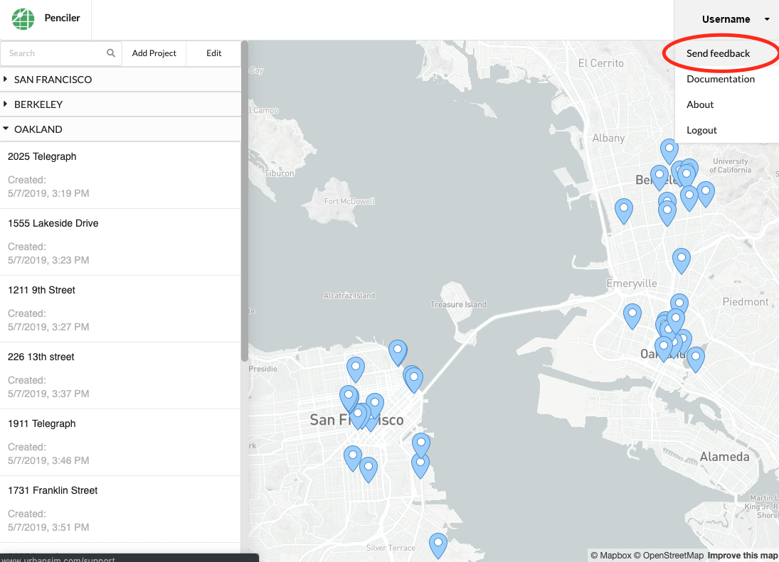
The home view of Penciler is a map of your region with a project list. Each project in the project list refers to an individual site. If you have projects in more than one city, they will be sorted under each city in the list. You can return home to the project list at any time by clicking on the Penciler logo in the top left corner.
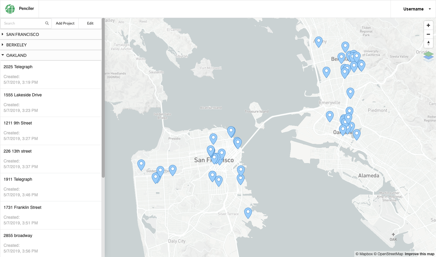
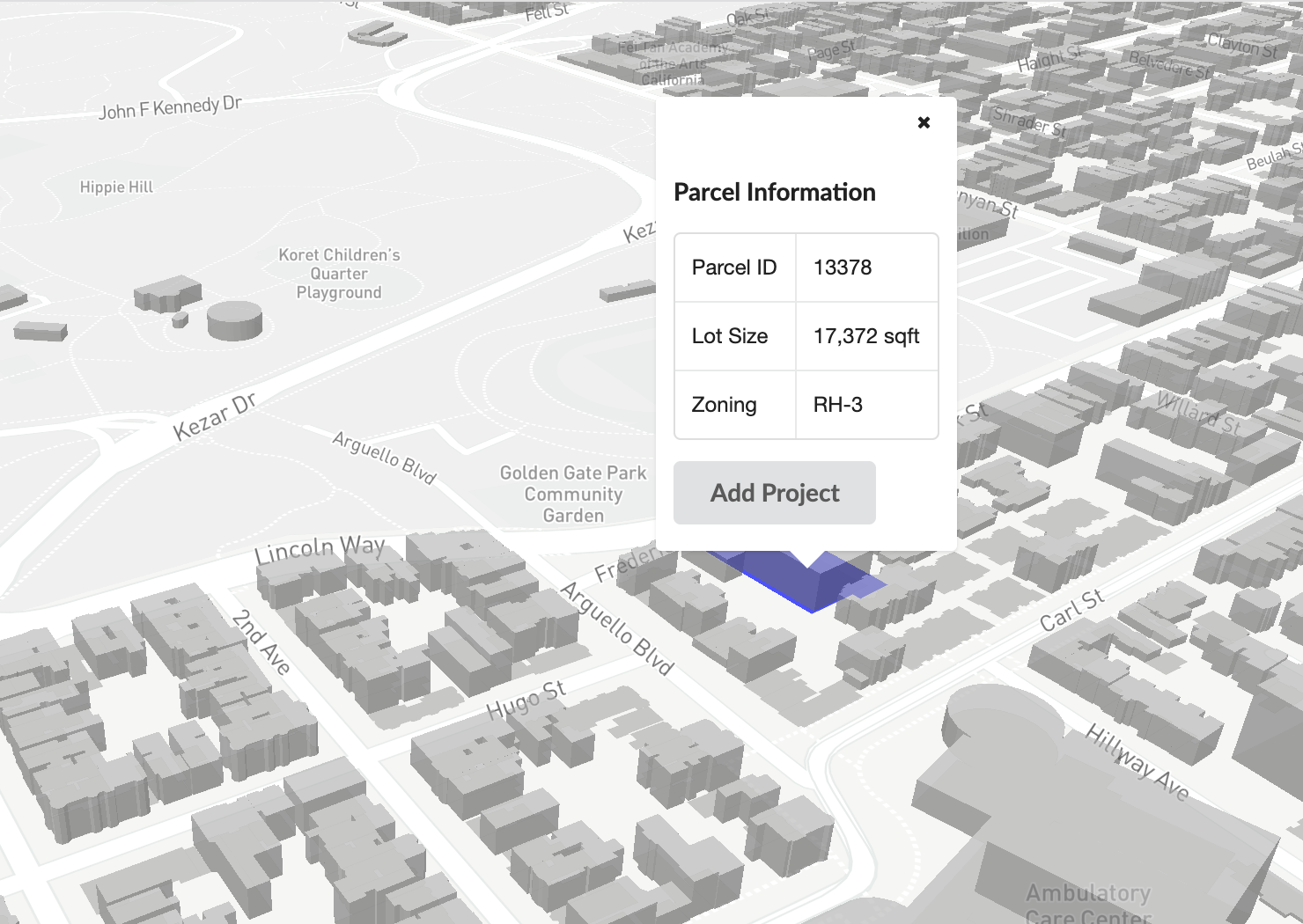
Clicking on any project in the project list will change your map view to zoom in to that parcel. Clicking ‘open’ on any project will bring you to the project home page. When you zoom in to see individual parcels you can directly select parcels in the map and see information about the parcel.
Deleting Projects
To delete a project, click ‘Edit’ on the home page and select the project to delete. Click ‘Done’ to return to the normal view.

Map Layers
To access the layers panel, click on the layers symbol on the right hand side of the map.

From the layers panel you can change the basemap, activate or deactivate building massings from OpenStreetMap, and add a zoning layer.
To change the basemap, select from the dropdown menu under ‘Basemap’.
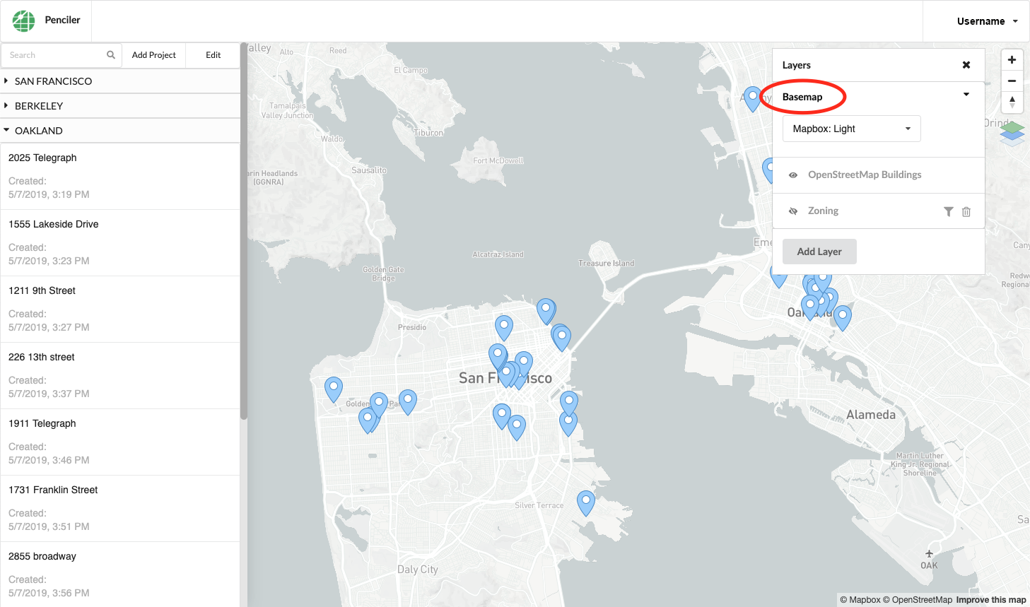
To activate or deactivate the building massings in the map, click ‘OpenStreetMap Buildings’.
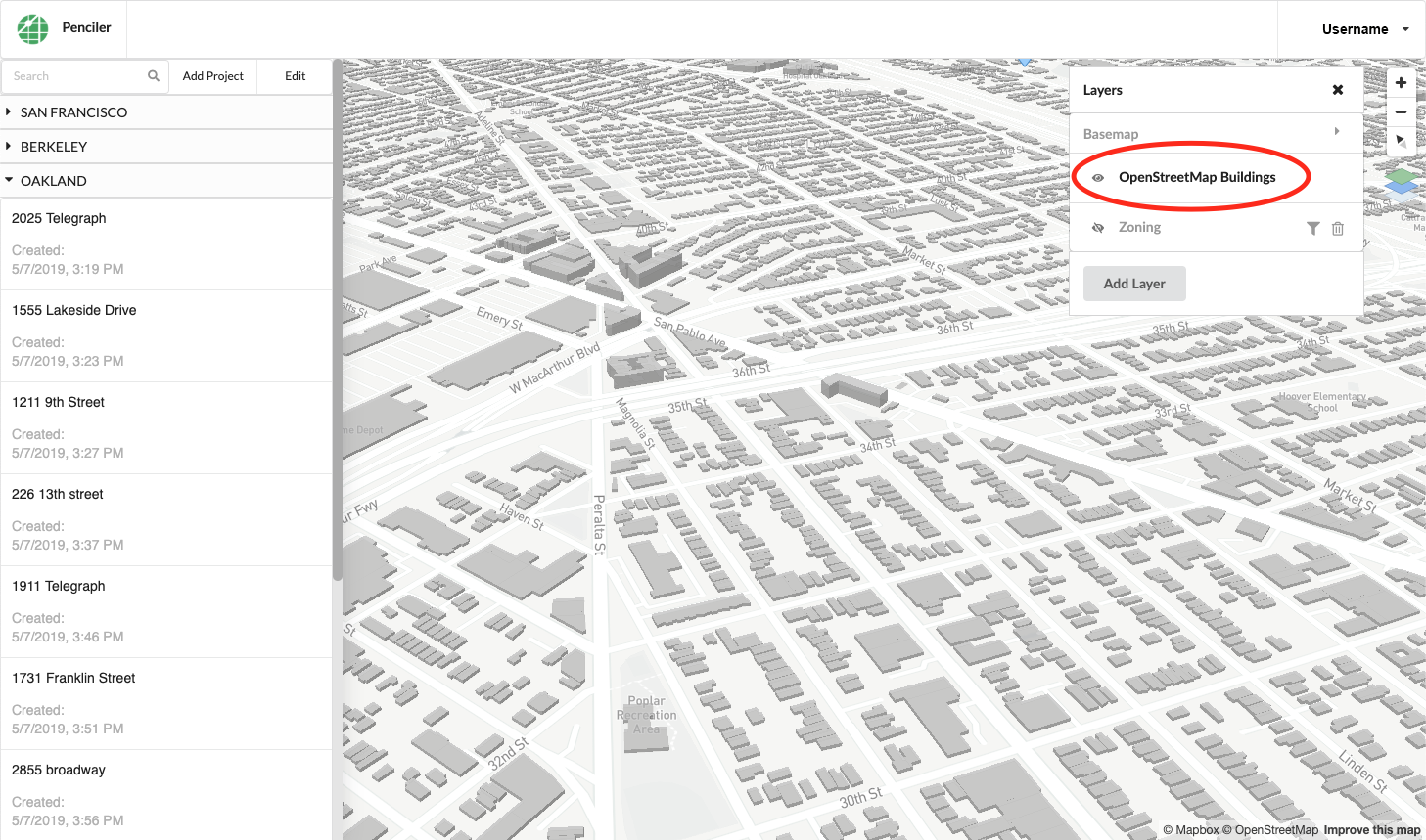
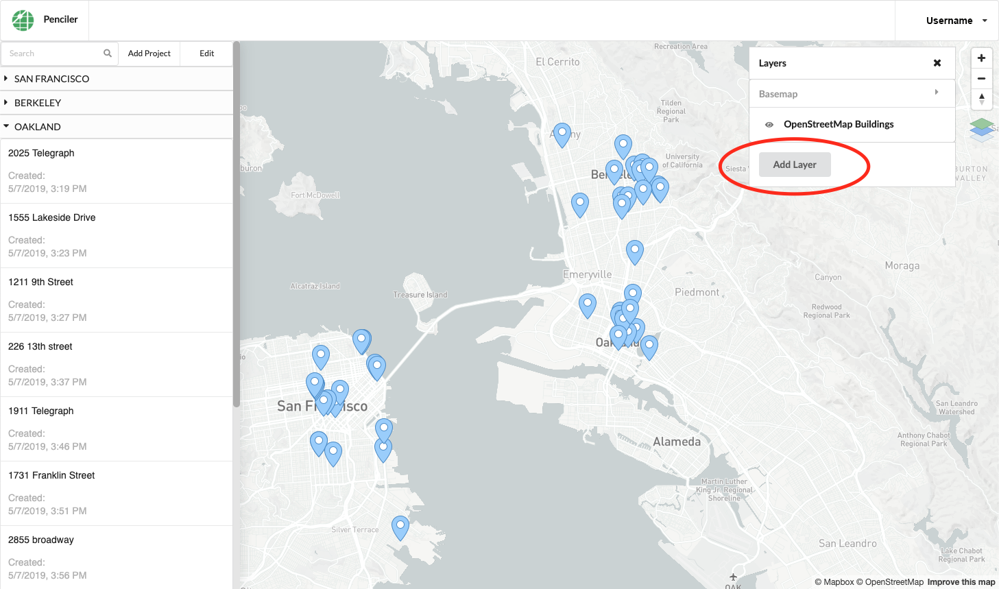
To add a zoning layer, click ‘Add Layer’ at the bottom of the panel and select ‘Zoning’.
You can filter by city and by zoning category. For example, you can remove Berkeley and Oakland and industrial, public and open space, miscellaneous, single family residential and low density multifamily residential so that you are only shown medium and high density multifamily residential zoning in San Francisco. Some zoning designations can have multiple categories, like medium density multifamily residential and neighborhood commercial.
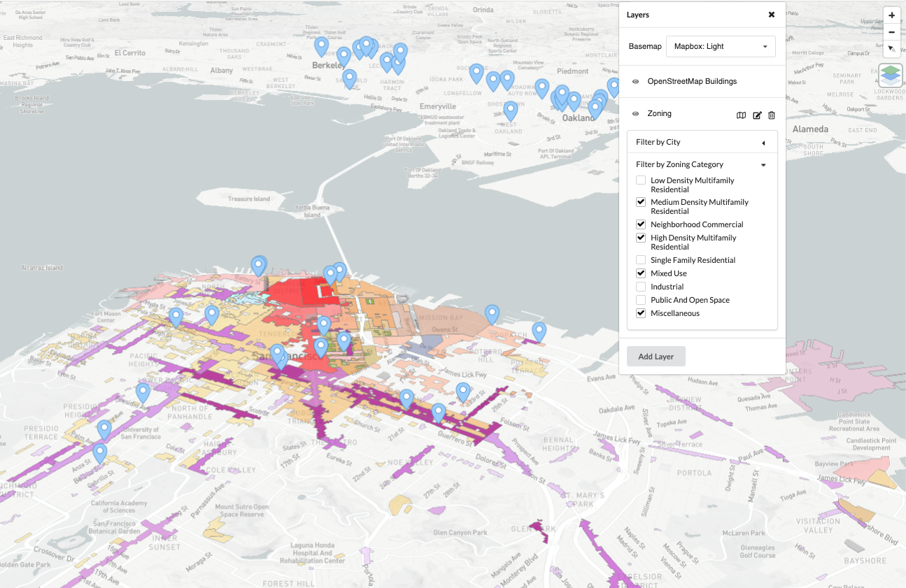
- The following standards were used to categorize the zoning designations:
Single Family Residential includes zoning categories requiring one residential unit per lot.
Low Density Multifamily Residential includes zoning categories requiring 700 GSF of lot per unit or greater.
Medium Density Multifamily Residential includes zoning categories requiring 300 GSF of lot per unit to 700 GSF of lot per unit.
High Density Multifamily Residential includes zoning categories requiring less than 300 GSF of lot per unit.
Neighborhood Commercial includes zoning categories that encourage pedestrian-oriented retail.
Mixed use includes zoning categories where large-scale commercial, office and/or residential uses are combined.
Industrial includes zoning designations primarily for industrial uses.
Public and Open Space includes zoning designations for open space and publicly-owned land.
Miscellaneous includes specialized zoning designations like hospitals or essential services.
To start a new project, see here.
Summary Table
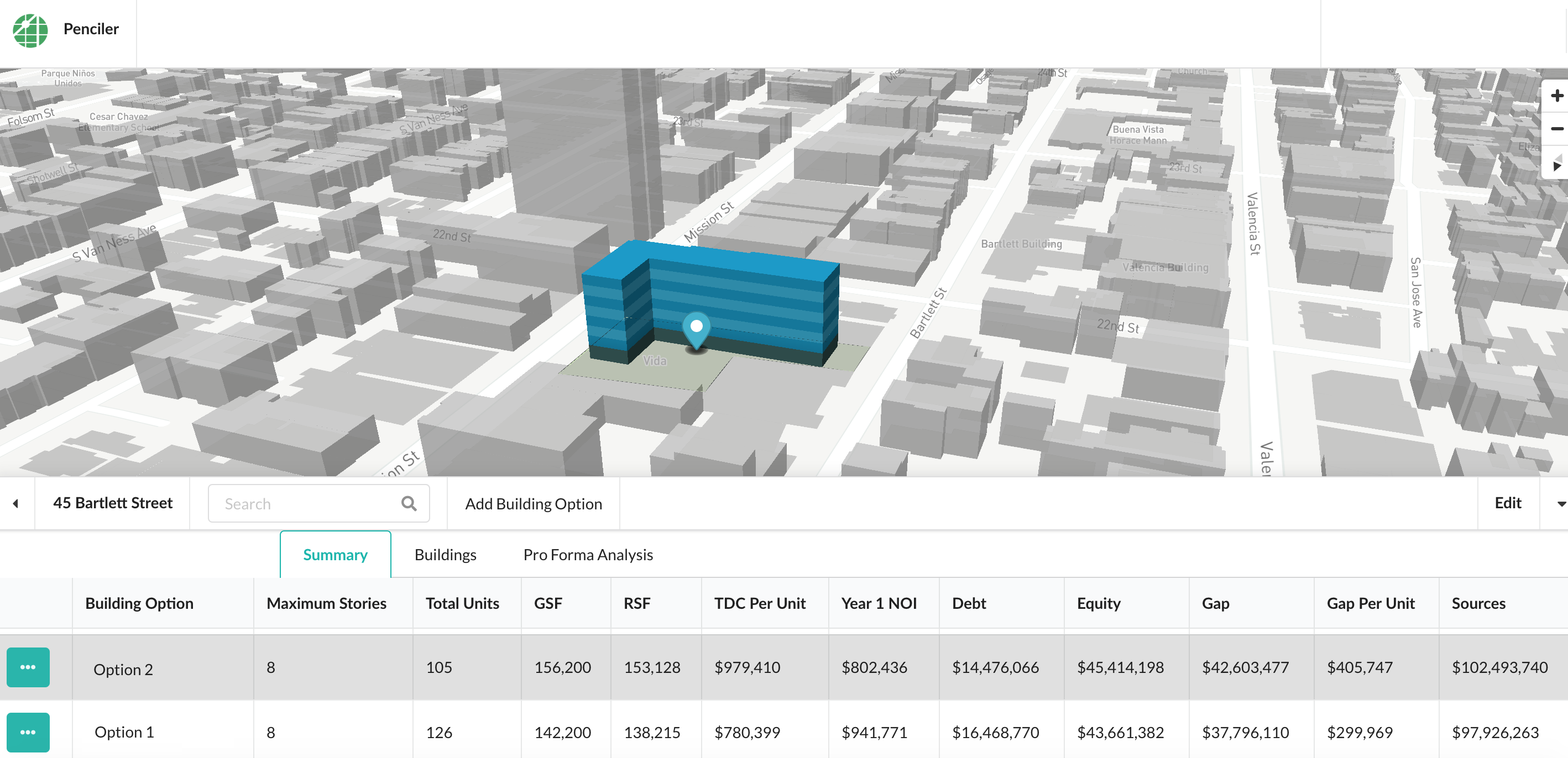
The Summary tab will show you a table with values for each phase of your analysis for each building option that you create. From the Summary Table you can also download a 20-year cash flow and a PDF summary for each building option.
Support
To send feedback or request help, click on ‘Send feedback’ in the dropdown menu under your username.
